Featured Work
Community Projects
Real-world solutions and implementations
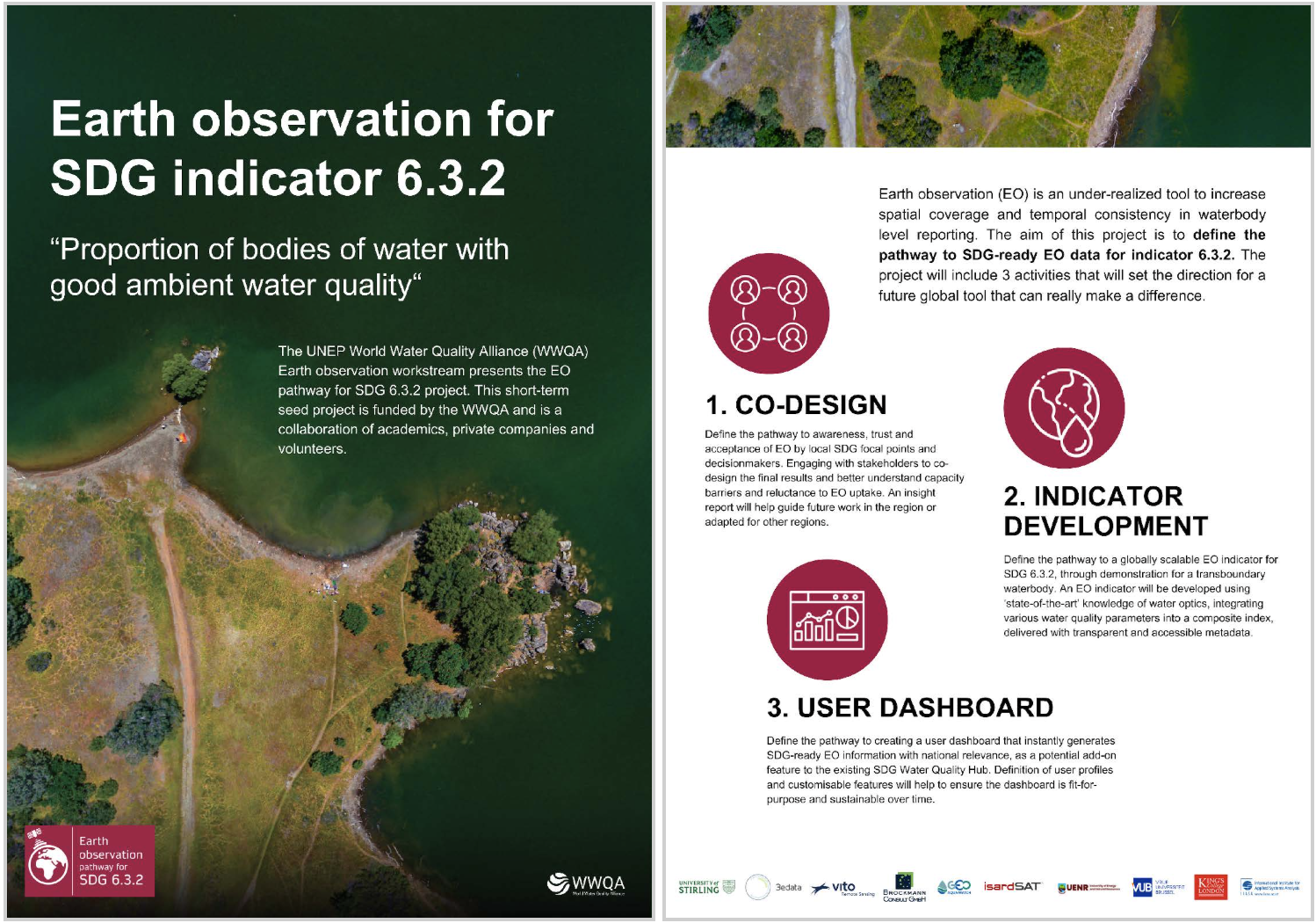
UNEP WWQA Funded "Earth observation pathway for SDG 6.3.2" project
Defining a remotely sensed multi-metric index in Lake Tanganyka to provide information on freshwater quality and how it changes over time. Framed within SDG 6 (Clean Water and Sanitation).
Learn More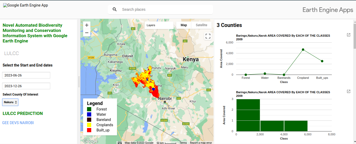
Automated Biodiversity Monitoring System with Google Earth Engine
An innovative automated system leveraging Google Earth Engine for biodiversity monitoring and conservation with real-time insights into ecosystem health.
Learn More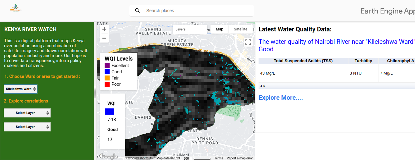
Nairobi River (Kenya RiverWatch Monitoring)
Comprehensive water quality monitoring system using advanced geospatial technologies and real-time data processing to track environmental changes.
Learn More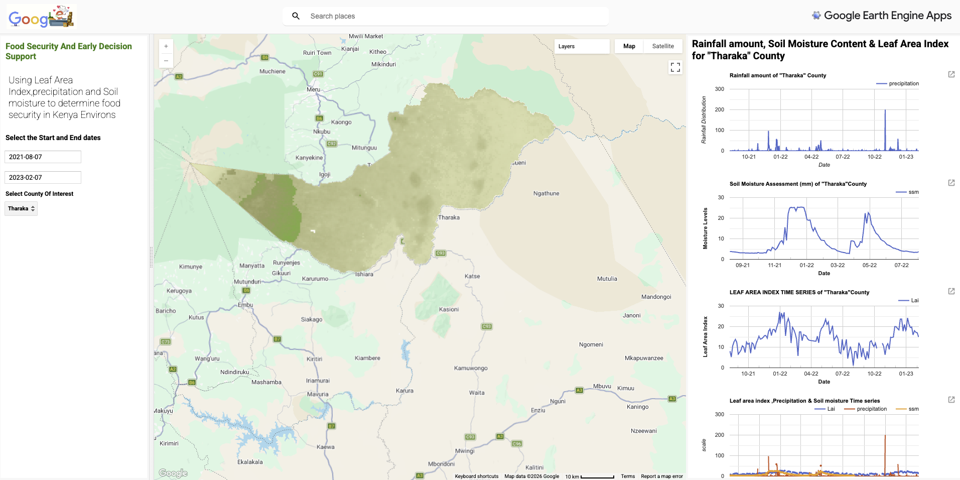
Food Security and Early Decision Support
A Google Earth Engine application that uses Leaf Area Index, precipitation, and soil moisture data to determine food security in Kenya. Provides interactive time series analysis for rainfall, soil moisture content, and vegetation health at the county level.
Learn More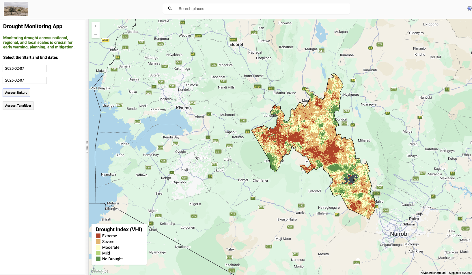
Drought Monitoring App
A Google Earth Engine application for monitoring drought across national, county, and sub-county levels in Kenya using the Vegetation Health Index (VHI). Classifies drought severity into Extreme, Moderate, Mild, and No Drought categories with interactive date selection and regional filtering.
Learn More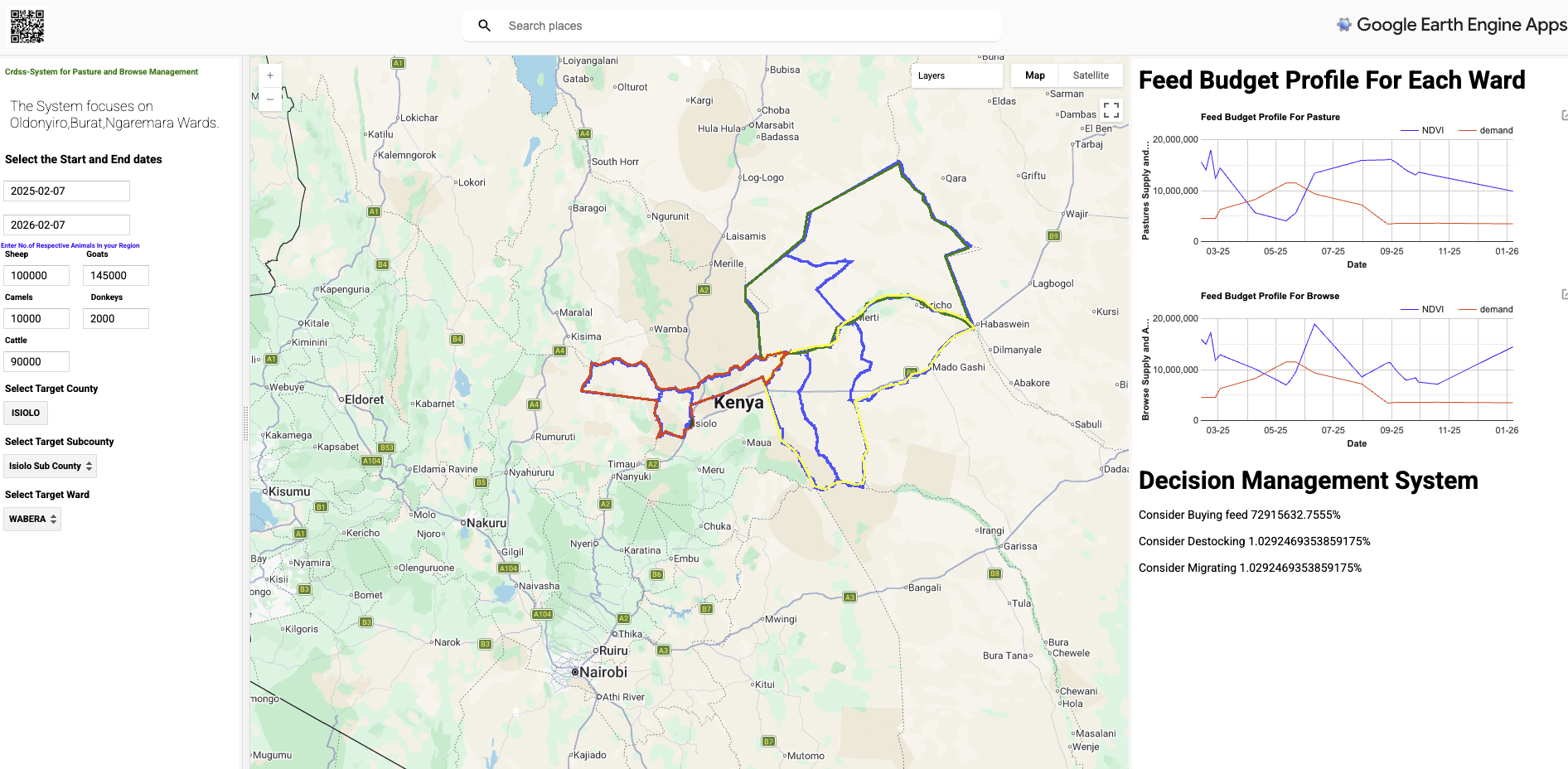
Feed Budget Profile & Decision Management System
A Google Earth Engine application for pasture and biomass management, providing feed budget profiles at the ward level. Features a decision management system that calculates carrying capacity for buying feed, destocking, and migrating livestock across counties and sub-counties in Kenya.
Learn More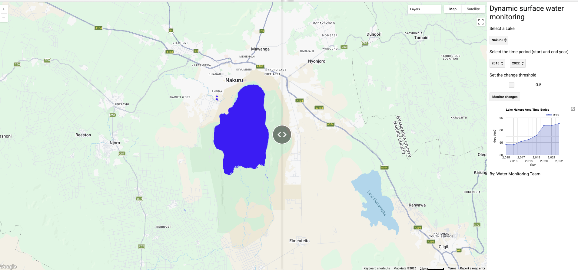
Dynamic Surface Water Monitoring
A Google Earth Engine application for monitoring surface water dynamics over time. Tracks changes in water extent using satellite imagery, with time series analysis of lake surface area and configurable change thresholds for detecting water body fluctuations.
Learn More