Featured Community Projects
Real-world solutions and implementations.
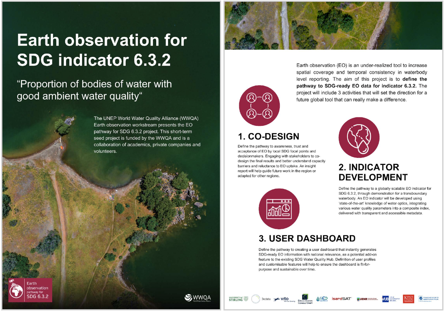
UNEP WWQA Funded “Earth observation pathway for SDG 6.3.2” project
The awarded project focused on defining a remotely sensed multi-metric index in a pilot area in Africa (Lake Tanganyka) to provide information on freshwater quality and how it changes over time. The aim is to generate a mechanism, co-designed with local stakeholders and focal points, to determine whether efforts to improve water quality are working, through an indicator that can be obtained at a global scale, using the full potential of applied remote sensing. This indicator is framed within Sustainable Development Goal 6 (SDG – Clean Water and Sanitation), which seeks to achieve improved water quality, wastewater treatment and safe reuse, and specifically in indicator 6.3.2 “Proportion of bodies of water with good ambient water quality”.
Learn More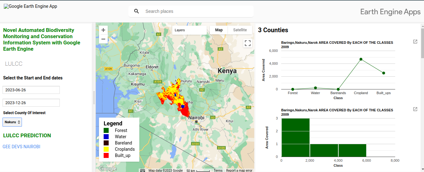
A Novel Automated Biodiversity Monitoring and Conservation Information System with Google Earth Engine
An innovative automated system leveraging Google Earth Engine for biodiversity monitoring and conservation. This solution provides real-time insights into ecosystem health and biodiversity patterns.
Learn More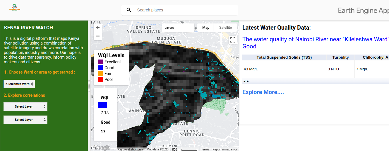
Nairobi River (Kenya RiverWatch Monitoring)
A comprehensive water quality monitoring system for Nairobi River using advanced geospatial technologies and real-time data processing to track environmental changes and water quality metrics.
Learn More
A Novel Automated Biodiversity Monitoring and Conservation Information System with Google Earth Engine
An innovative automated system leveraging Google Earth Engine for biodiversity monitoring and conservation. This solution provides real-time insights into ecosystem health and biodiversity patterns.
Learn More